Key Details
- Where: Western United States
- Start: Campo, Mexican Border (USA)
- End: Manning Park, Canadian Border (Canada)
- Dates: 02/05/2018 – 16/08/2018 (107 days)
- Length: 2650 miles (4264km)
Trail Journal
I uploaded photos and kept daily notes in a Google Photos album (linked below). You can find more information there. At the bottom of this page are few highlights.

Mileage Data
As a part of my trail journal, I noted down which “Mile” I was at by the end of the day. After my hike I put this daily cumulative total into a spreadsheet. From this I created a few interesting charts and calculated a few statistics, because who doesn’t honestly enjoy a bit of back-patting after working hard at something?

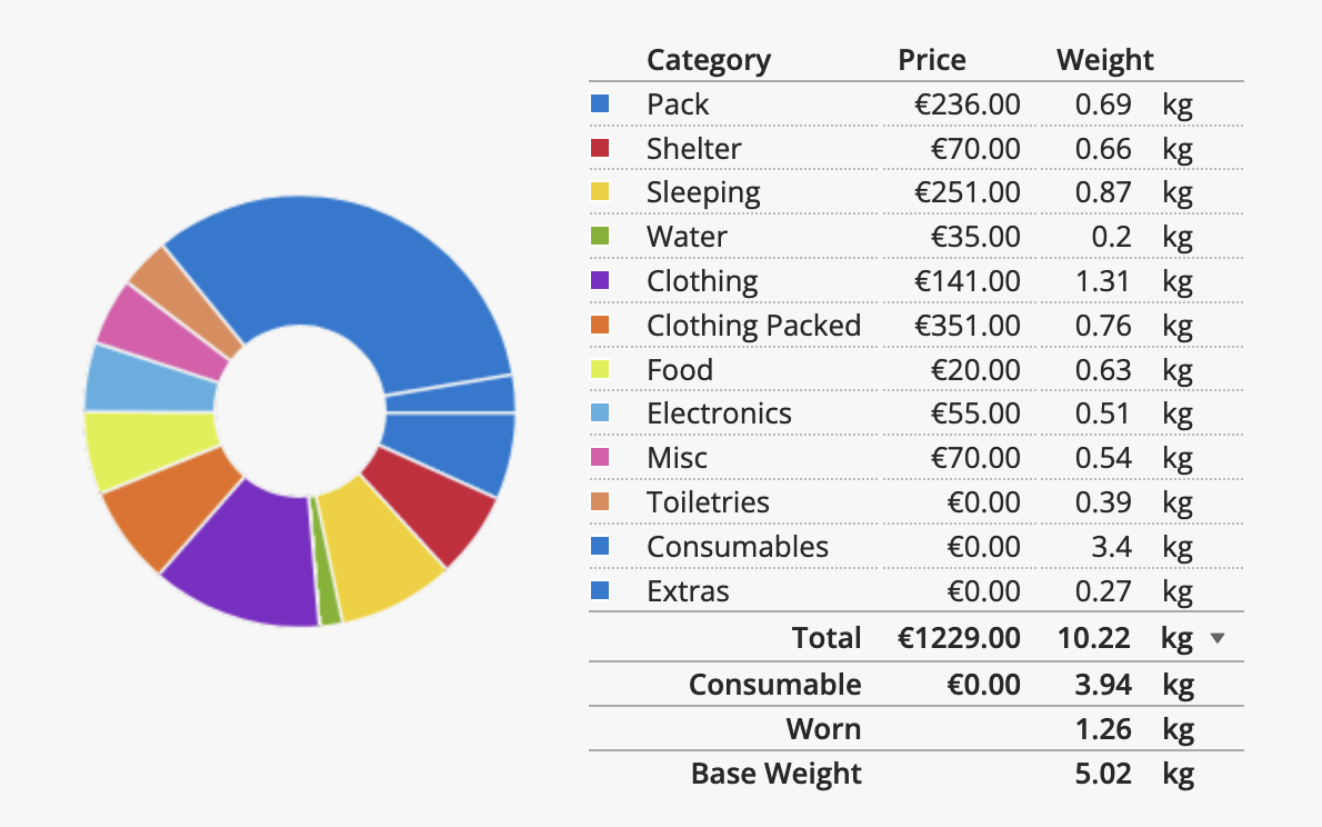
Gear
Some things changed over the trail, but by-and-large it stayed the same. I actually started out lighter and added in some luxuries along the way. Amongst these were: sleeping socks, an inflatable pillow and a tyvek groundsheet (before I was using polycryo, which is like an unstretchy cling-film).
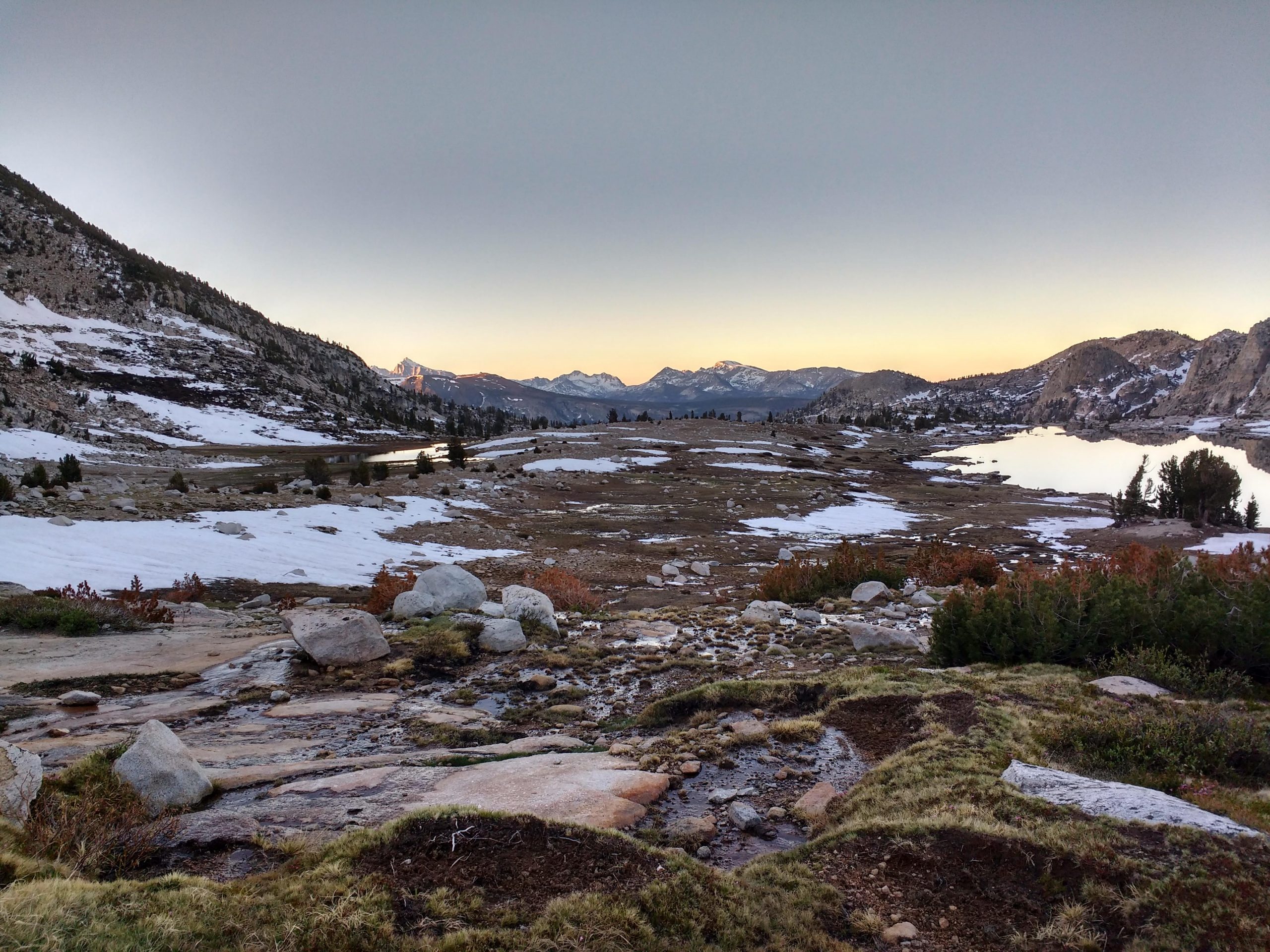
Gallery


