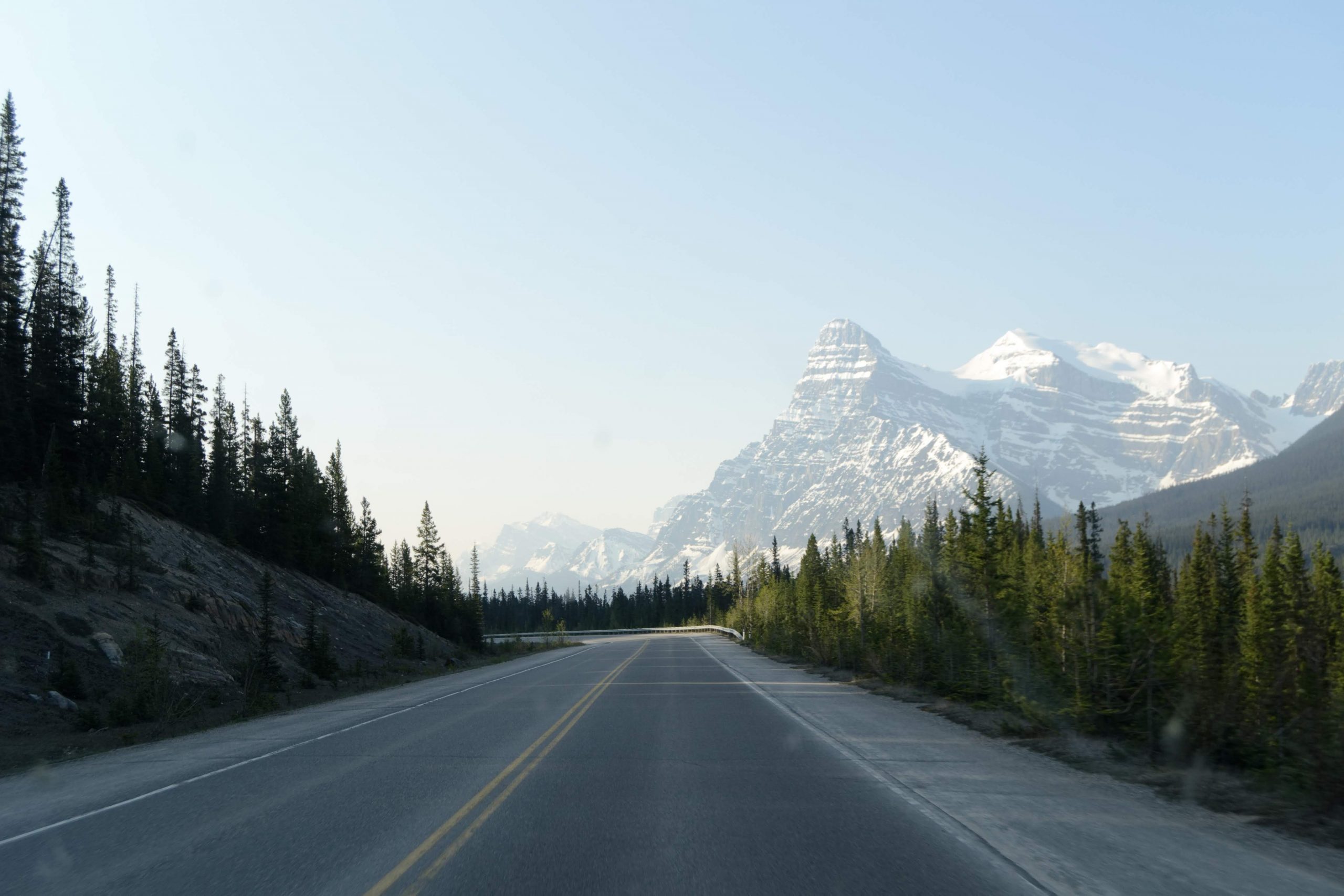
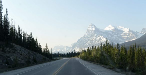
After the PCT in 2018, Lina and I spent a year traveling around South West Canada. I won’t recount all of our travels here, but we spent most of the Summer of 2019 on hikes and easy scrambles, mainly in the Rockies, but also in the Coast Mountains.
Guidebooks
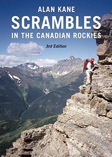
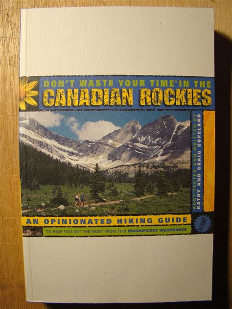
We relied on three books:
- Scrambles in the Canadian Rockies (3rd Edition) – Alan Kane – This book was wonderful, and I think the one we used most. To my mind the descriptions were just enough to leave a sense of adventure most of the time, the difficulty ratings were good, and the objectives were usually interesting.
- Don’t waste your time in the Canadian Rockies – Kathy & Craig Copeland – We got an older version of this guide second hand, and it was a nice compliment to our scrambles book, as they never overlapped (this book was focused on fun and scenic hikes).
- 105 Hikes In and Around Southwestern British Columbia – Stephen Hui – This was my least favourite of our books, but it was fine to find interesting hikes for the few weeks we spent in the Coast Mountains North of Vancouver.
My Favourites
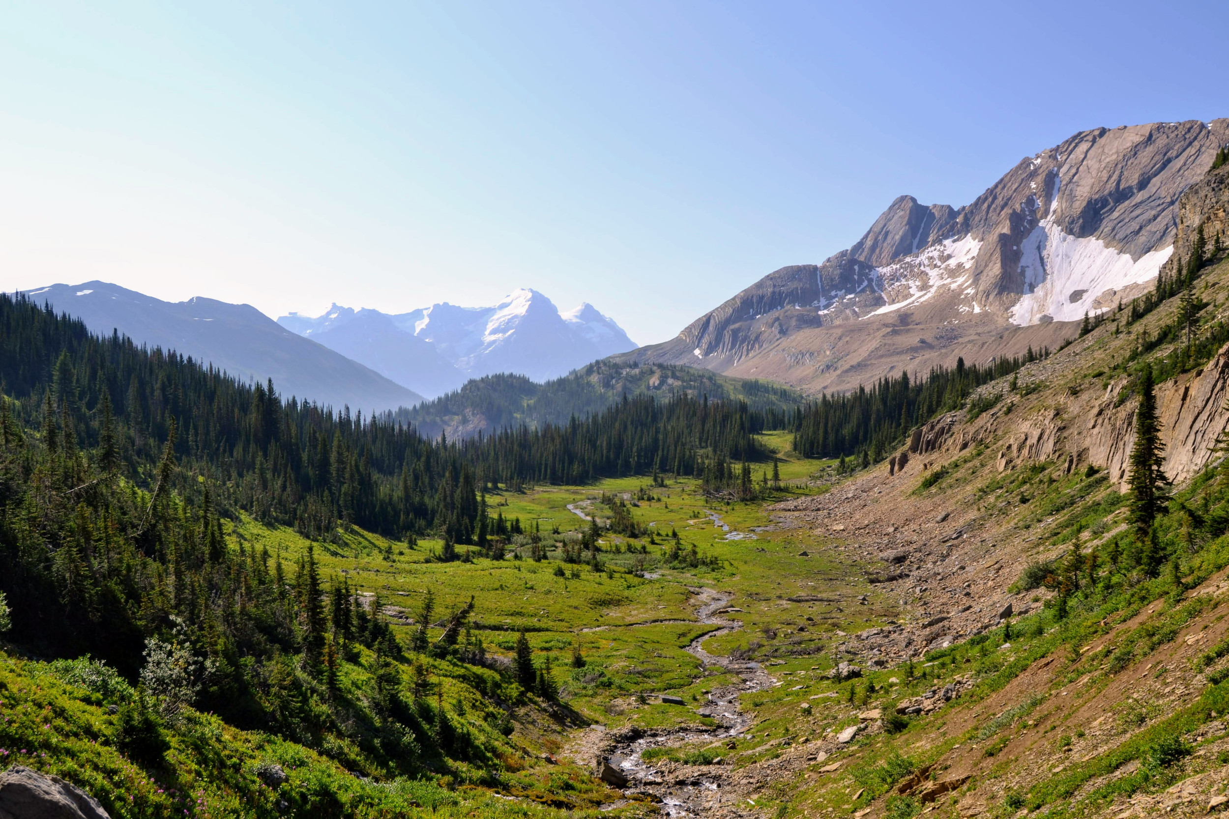
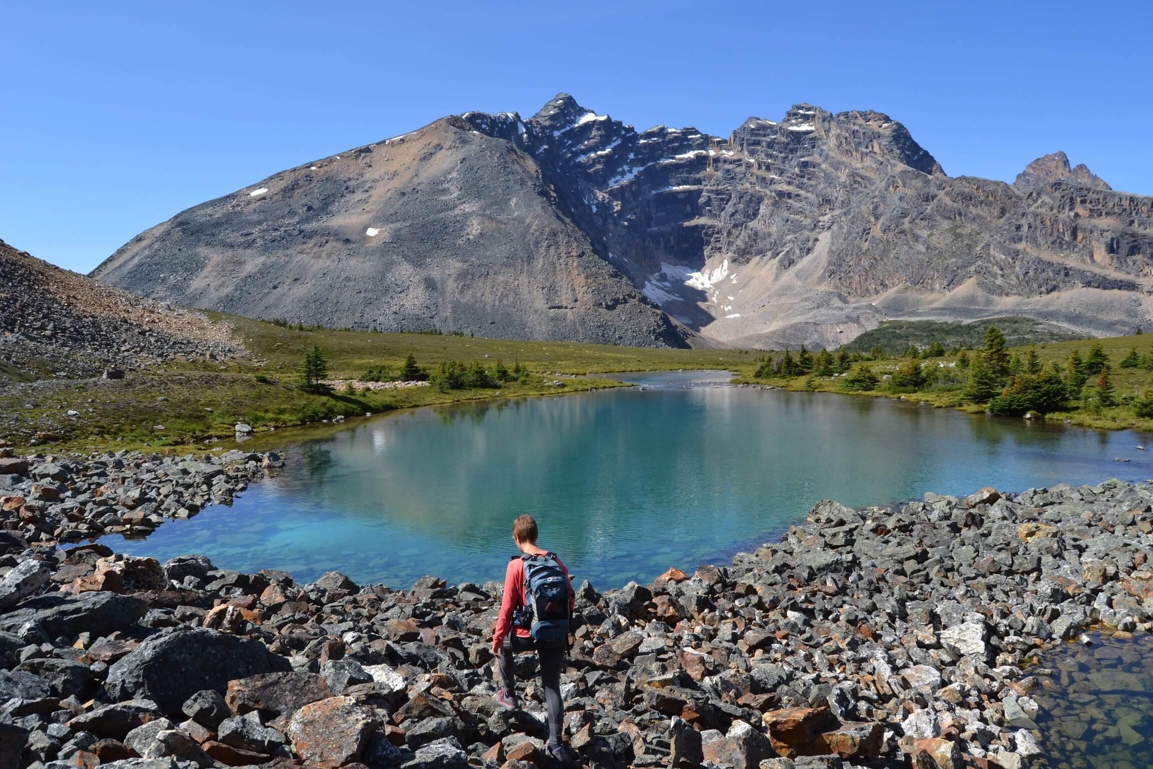
Mount Niles
Date: 08/08/2019
Region: Yoho NP, AB
Distance: 23km
Elevation gain: 1350m
High point: 2972m
Difficulty: Easy scrambling
This one was just great from start to finish. From the very start you walk along a lake with views of Mount Niles. You come up out of the forest into Niles Meadow, which felt remote and pristine with the peak beckoning you up. As you get closer and closer to the summit the views just keep getting better. Finally at the top you are treated to expansive views over the Waputik Icefield.
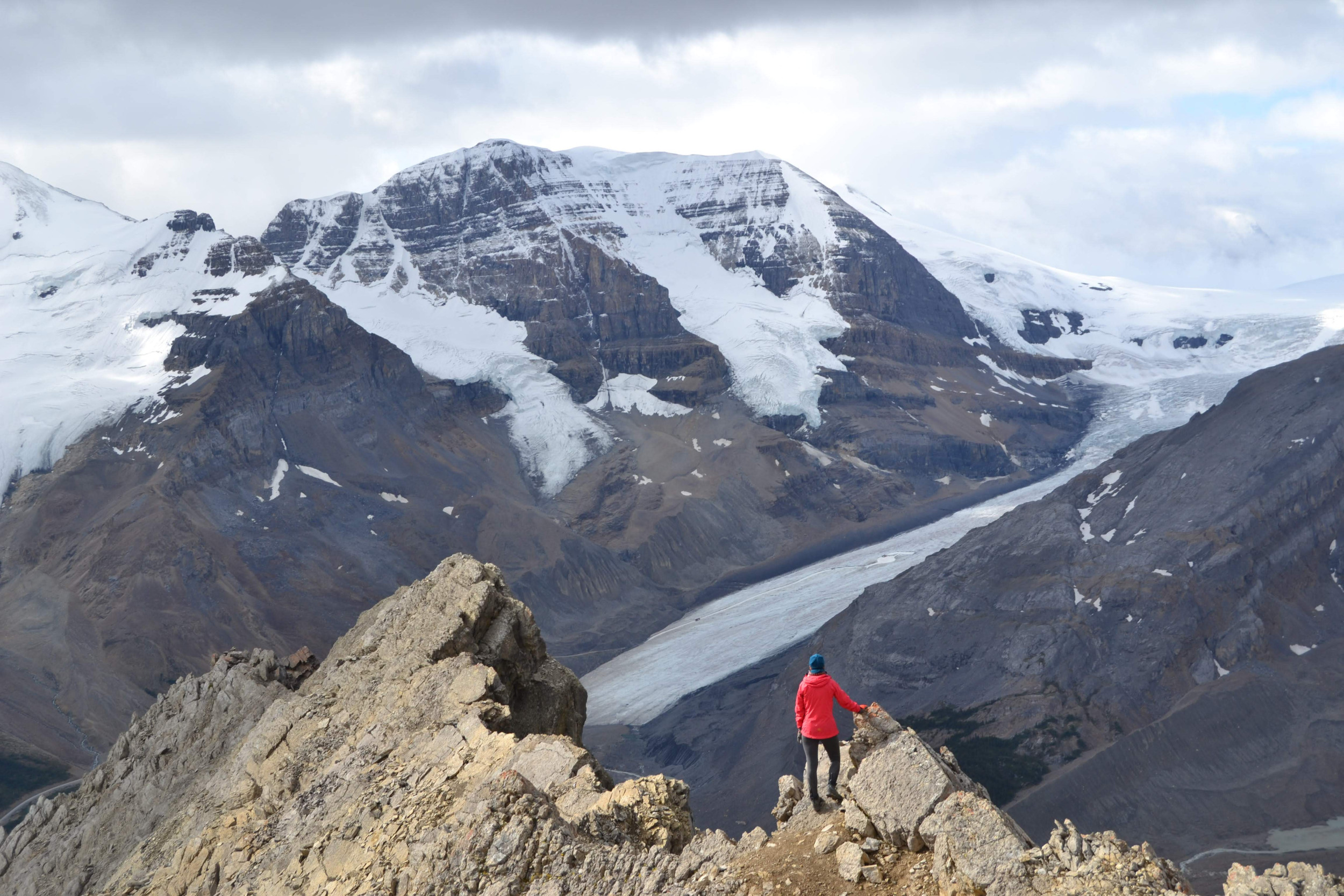
Mount Wilcox
Date: 16/08/2019
Region: Icefields Parkway North, AB
Elevation gain: 850m
High point: 2892m
Difficulty: Moderate scramble
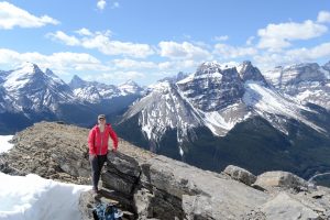
Not very long, but great fun. So much so that I did this one 2 days in a row (I went back the 2nd time with Lina). This was the most “scrambly” of the peaks we did, rather than lots of scree slopes, this one was more often on rocks and required the use of hands a lot. It didn’t hurt that you have great views of the Athabasca Glacier and surrounding peaks.
Mount Temple
Date: 03/08/2019
Region: Lake Louise, AB
Distance: 15km
Elevation gain: 1700m
High point: 3544m
Difficulty: Moderate Scramble
I think on the 3rd attempt we woke up early enough to secure a spot in the Lake Moraine car park (4am). Although this mountain is really popular, which is usually a bit of a turn-off for me, it did feel momentous to go up it. Looking at it from below (from the North-East) it seems so daunting, but the route up the back is much more gradual. I thought it was worth the hype.

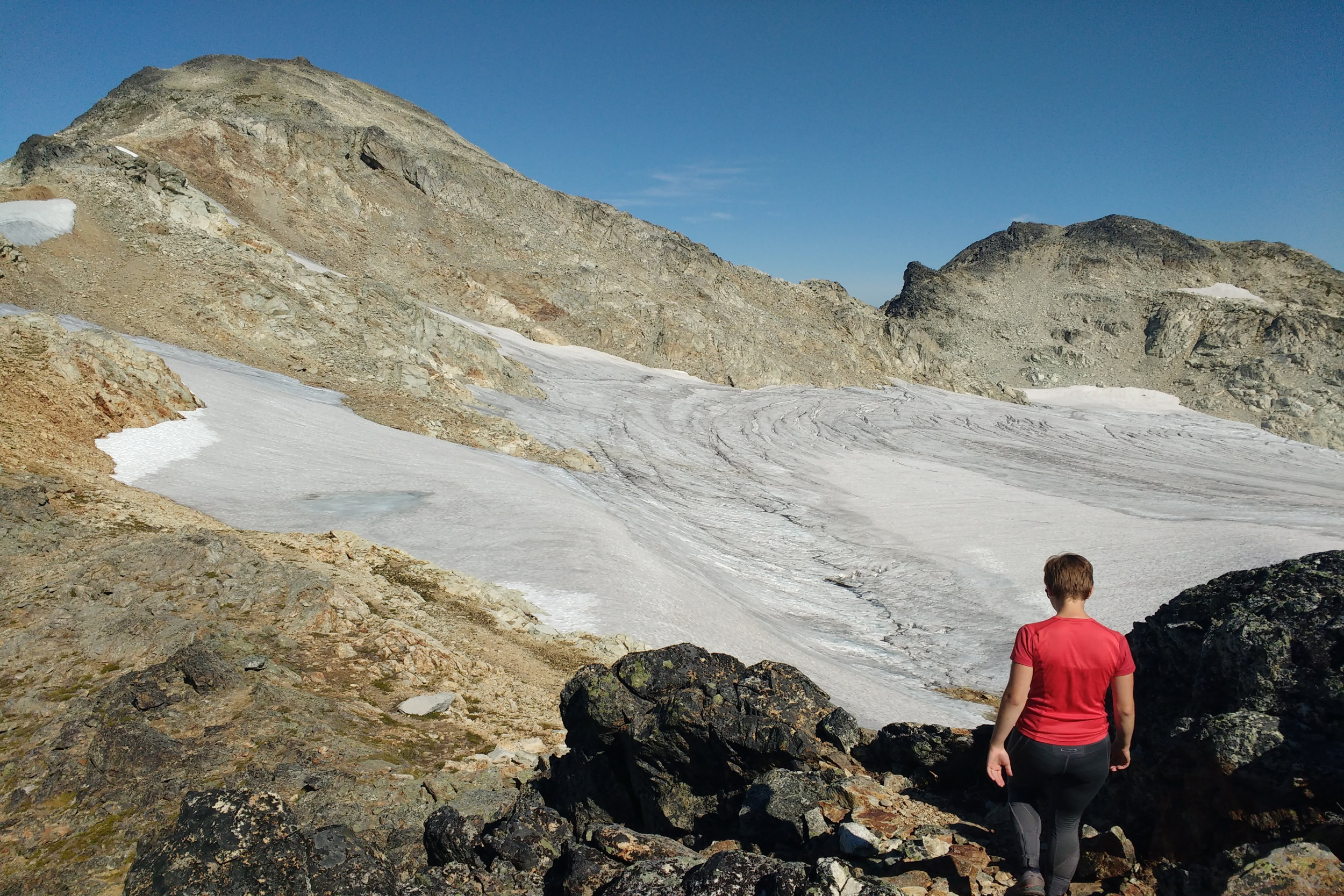
Brandywine Mountain
Date: 06/09/2019
Region: Whistler, BC
Distance: 18km
Elevation gain: 1500m
High point: 2213m
Difficulty: Easy scramble
With the rough 4WD track leading in (we took out 2WD van as far as we were comfortable) and the snow fields towards the top this one had a real sense of adventure for us. The views from the top were amazing, with incredibly dramatic peaks all around.
Healy Pass
Date: 30/07/2019
Region: Banff, AB
Distance: 18.4km
Elevation gain: 655m
Difficulty: Easy hike
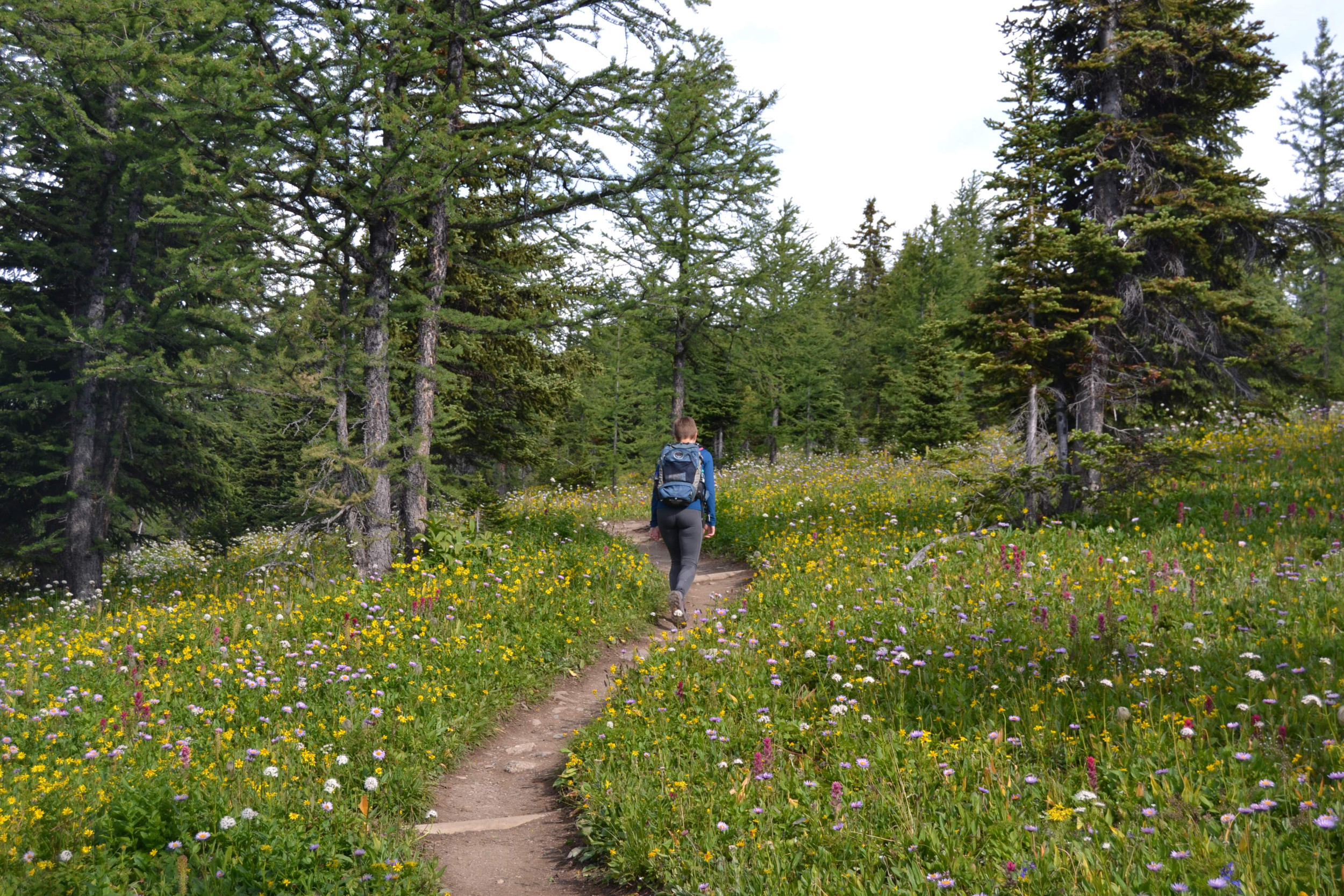
The hike up from the car park is a bit of a slog, but the rewards are worth it. Dense wildflower meadows as far as the eye can see. It’s always a pleasure and a privilege to witness spectacles of nature and this certainly feels like one of them. I’m not sure how big the window is to see this (I think we must have googled it before hand), but when we were there it seemed to be in full bloom.
Chronological List
Below is a chronological list of some of some of the hiking trips from our time in Canada, I think I’ve included most of the peaks we did; lots of day hikes have been omitted. Not all entries have the same information, and since I no longer have the books to consult, any difficulty ratings I give are my own (to be taken with a pinch of salt).
Peak: Windtower
Date: 24/10/2018
Region: Kananaskis/Canmore, AB
Elevation gain: 900m
Difficulty: Easy scramble
Peak: Mt Lady Macdonald (false summit)
Date: 26/09/2018
Region: Canmore, AB
Elevation gain: 1300m
High point: 2600m
Difficulty: Easy scramble (until the summit ridge, then difficult)
Notes: I started along the summit ridge, but it’s seriously exposed, I was alone and in trail runners and so didn’t feel mentally up to it. Turned around after about 10m.
Peak: Stawamus Chief
Date: 19/05/2019
Region: Squamish, BC
Difficulty: Moderate hike
Notes: It was very busy (I think we were there on a public holiday long-weekend). We went along peaks 1, 2 and 3. There are some fun ladders and chains that connect the different peaks.
Peak: Grotto Mountain
Date: 30/05/2019
Region: Canmore, AB
Distance: 9km
Elevation gain: 1355m
Difficulty: Easy scramble
Peak: Paget Peak
Date: 04/06/2019
Region: Field, BC
Elevation gain: 960m
High point: 2560m
Difficulty: Easy scramble
Notes: Lina’s first scramble
Peak: Mount Yamnuska
Date: 08/06/2019
Region: Kananaskis, AB
Elevation gain: 940m
High point: 2240m
Difficulty: Easy scramble
Notes: Lots of fresh snow, made trail finding interesting.
Peak: Mount Olive
Date: 11/06/2019
Region: Wapta Icefield
High point: 3126m
Difficulty: Easy mountaineering
Notes: From Bow Hut, as part of a mountaineering course.
Peak: Mount Habel
Date: 12/06/2019
Region: Wapta Icefield
High point: 3087m
Difficulty: Easy mountaineering
Notes: From Bow Hut, as part of a mountaineering course.
Peak: Mount Gordon
Date: 13/06/2019
Region: Wapta Icefield
High point: 3161m
Difficulty: Easy mountaineering
Notes: From Bow Hut, as part of a mountaineering course.
Hike: Lineham Ridge
Date: 19/06/2019
Region: Waterton Lakes, AB
Distance: 14km
Elevation gain: 922m (from the road)
High point: 2500m
Difficulty: Moderate hike
Notes: When were were there the road was closed due to recent wildfires (I think from the year before), so we rented bikes and cycled to the start of the hike. When we were at the top a storm came in and we descended among a lot of hail and lightning.
Peak: Turtle Mountain
Date: 22/06/2019
Region: Crowsnest Pass, AB
Distance: 7.5km
Elevation gain: 940m
High point: 2210m
Difficulty: Easy Scramble
Notes: Location of the “Frank slide” in 1903, the deadliest landslide in Canada’s history.
Hike: Three Sisters
Date: 25/06/2019
Region: Fernie, BC
Distance: 34km
Elevation gain: 1930m
High point: 2788m
Difficulty: Easy-Moderate, but very long.
Notes: We saw some large bear prints in the snow on our way up.
Peak: Crowsnest Mountain (attempt)
Date: 29/06/2019
Region: Crowsnest Pass, AB
Difficulty: Moderate Scramble
Notes: There is a shaded gully, once the scrambling starts, and it was filled with ice and smooth hard snow. We didn’t have crampons with us so decided to turn around.
Peak: Sentry Mountain
Date: 30/06/2019
Region: Crowsnest Pass, AB
High point: 2420m
Difficulty: Moderate scramble (some difficult sections at the top)
Peak: Ward Mountain
Date: 01/07/2019
Region: Crowsnest Pass
Elevation gain: 835m
High point: 2530m
Difficulty: Easy scramble
Notes: Hike via Window Mountain Lake
Peaks: Heart Mountain & Grant MacEwan Peak
Date: 10/07/2019
Region: Bow Valley/Canmore, AB
Elevation gain: 850m
High point: 2149m
Difficulty: Easy scramble
Peak: Middle Sister
Date: 11/07/2019
Region: Canmore, AB
Distance: 17km
Elevation gain: 1520m
High point: 2769m
Difficulty: Easy scramble
Notes: Goats.
Peak: Mount Yamnuska (again)
Date: 13/07/2019
Region: Kananaskis, AB
Elevation gain: 940m
High point: 2240m
Difficulty: Easy scramble
Notes: No snow this time.
Peak: Mount Indefatigable (South peak)
Date: 14/07/2019
Region: Kananaskis, AB
Distance: 7km
Elevation gain: 940m
Difficulty: Strenuous hike, no real scrambling that I remember.
Notes: South peak is the easiest of the group.
Peak: Mount Burke
Date: 15/07/2019
Region: Cataract Creek, AB
Distance: 10.5km
Elevation gain: 896m
High point: 2551m
Difficulty: Moderate hike
Notes: A simple hike, great views over the plains below. We could see Calgary in the distance.
Hike: Burstall Pass
Date: 16/07/2019
Region: Kananaskis, AB
Distance: 16.5km
Elevation gain: 675m
Difficulty: Easy hike
Notes: This is supposedly a very popular trail but we didn’t see anyone else. It was cloudy on the day we went. We saw a moose.
Peak: The Fortress
Date: 17/07/2019
Region: Kananaskis, AB
Elevation gain: 1100m
High point: 3000m
Difficulty: Easy Scramble
Notes: The visibility was quite poor and I started ascending a scree field too early and had to backtrack.
Peak: Mount Sparrowhawk
Date: 18/07/2019
Region: Spray Lakes, AB
Elevation gain: 1340m
High point: 3121m
Difficulty: Easy scramble/tough hike
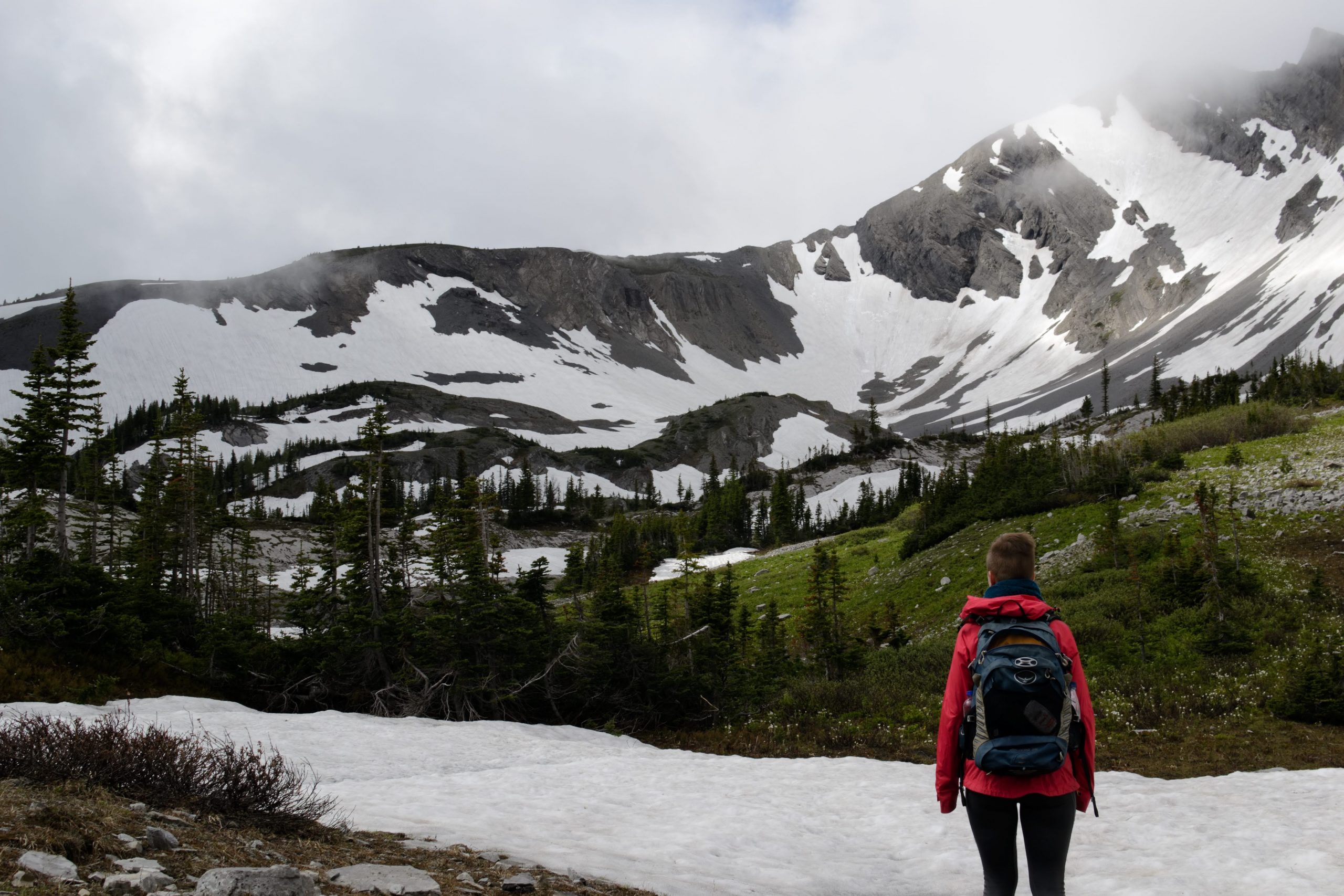
Notes: We didn’t actually make it to the summit. The weather really came in at the top and we were freezing. Thankfully there’s an emergency shelter just before the summit that was open. After hiding in there for an hour, we took the next patch of good weather to descend.
Peak: Mount Baldy
Date: 22/07/2019
Region: Kananaskis, AB
Elevation gain: 788m
High point: 2192m
Difficulty: Easy scrambling, with a moderately difficult crux
Notes: A fairly short scramble, but great fun, lots of good holds.
Hike: Mt Assiniboine Provincial Park
Dates: 23-25/07/2019
Distance: 63km
Difficulty: Easy hike
Notes: We did a “lollipop” route from the Mt Shark trailhead. The first day we hike in via Assiniboine Pass to Lake Magog campsite (26km). We spent a day hanging out there, doing a hike around Nub Peak (10km) for some spectacular photos (although the weather was terrible). And then retuning to the trailhead via Wonder Pass and Marvel Lake.
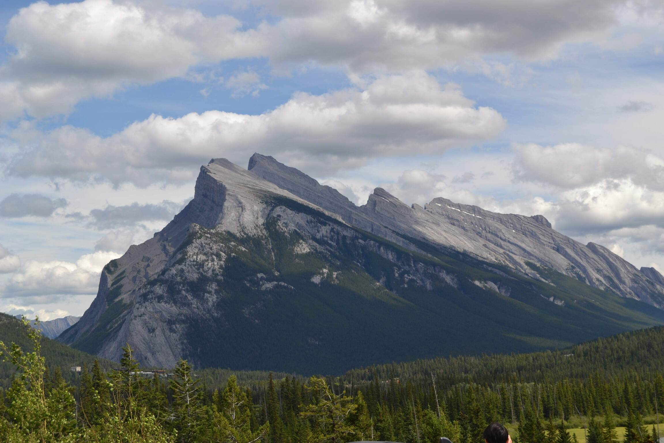
Peak: Mount Rundle
Date: 27/07/2019
Region: Banff, AB
Elevation gain: 1590m
High point: 2949m
Difficulty: Moderate scramble
Notes: We went up the main peak on the Banff side. Nothing technical, but well worn and slippy towards the top. We saw lots of people on our way down (it must have been a weekend).
Peak: Fairview Mountain
Date: 28/07/2019
Region: Lake Louise, AB
Distance: 9km
Elevation gain: 955m
High point: 2700m
Difficulty: Easy hike
Notes: Great views to effort ratio.

Peak: Castle Mountain
Date: 28/07/2019
Region: Lake Louise, AB
Distance: 26km
Elevation gain: 1400m
High point: 2385m
Difficulty: Easy scrambling, but long
Hike: Healy Pass
Date: 30/07/2019
Region: Banff, AB
Distance: 18.4km
Elevation gain: 655m
Difficulty: Easy hike
Notes: The most beautiful bountiful wildflower meadows I have ever seen.
Peak: Mount Bourgeau
Date: 31/07/2019
Region: Banff, AB
Distance: 22.4km
Elevation gain: 1500m
High point: 2931m
Difficulty: Moderate hike
Notes: Surprisingly easy for so much elevation gain, but maybe we finally started getting our trail legs.
Peak: Mount Temple
Date: 03/08/2019
Region: Lake Louise, AB
Distance: 15km
Elevation gain: 1700m
High point: 3544m
Difficulty: Moderate Scramble
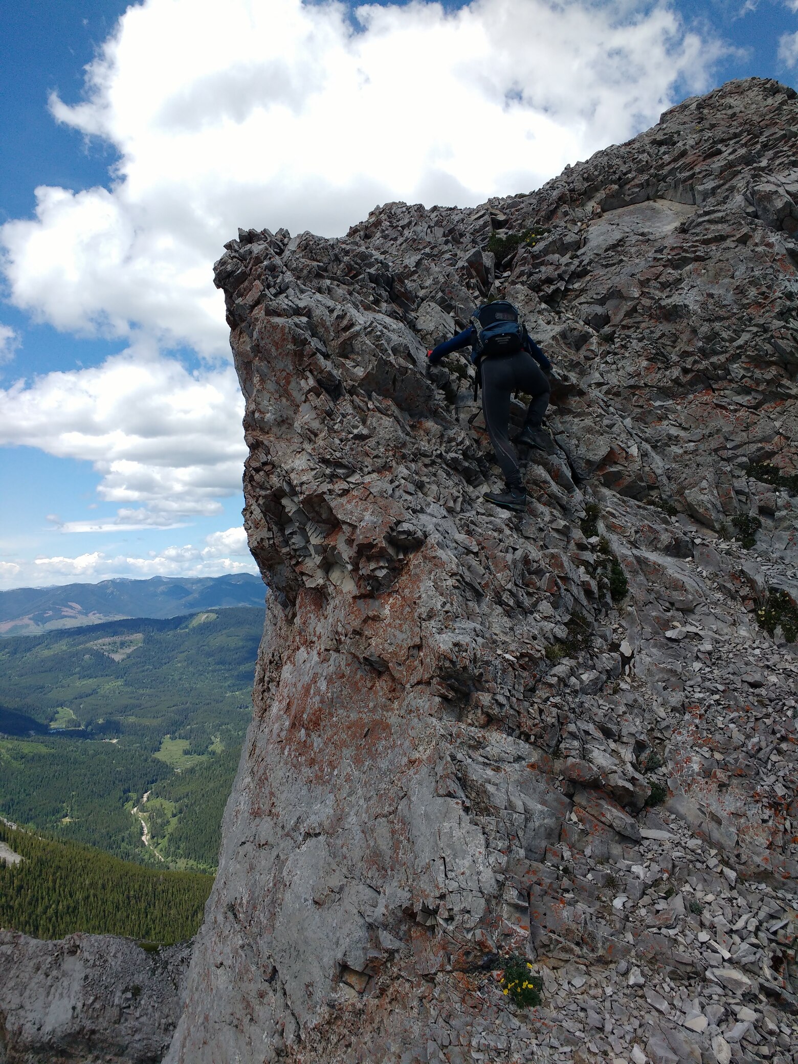
Notes: Very busy, I was there on a weekend. We needed to get up at 4am to get a place in the Lake Moraine car park. The crux that requires a bit of climbing was already occupied when I got there, since I had crampons and an ice axe with me I went up the gully to the left as it was filled with enough hard snow to climb.
Hike: Iceline
Date: 04/08/2019
Region: Yoho NP, BC
Distance: 30km
Elevation gain: 875m
Difficulty: Moderate hike
Notes: Great views the whole way. We continued on and looped back.
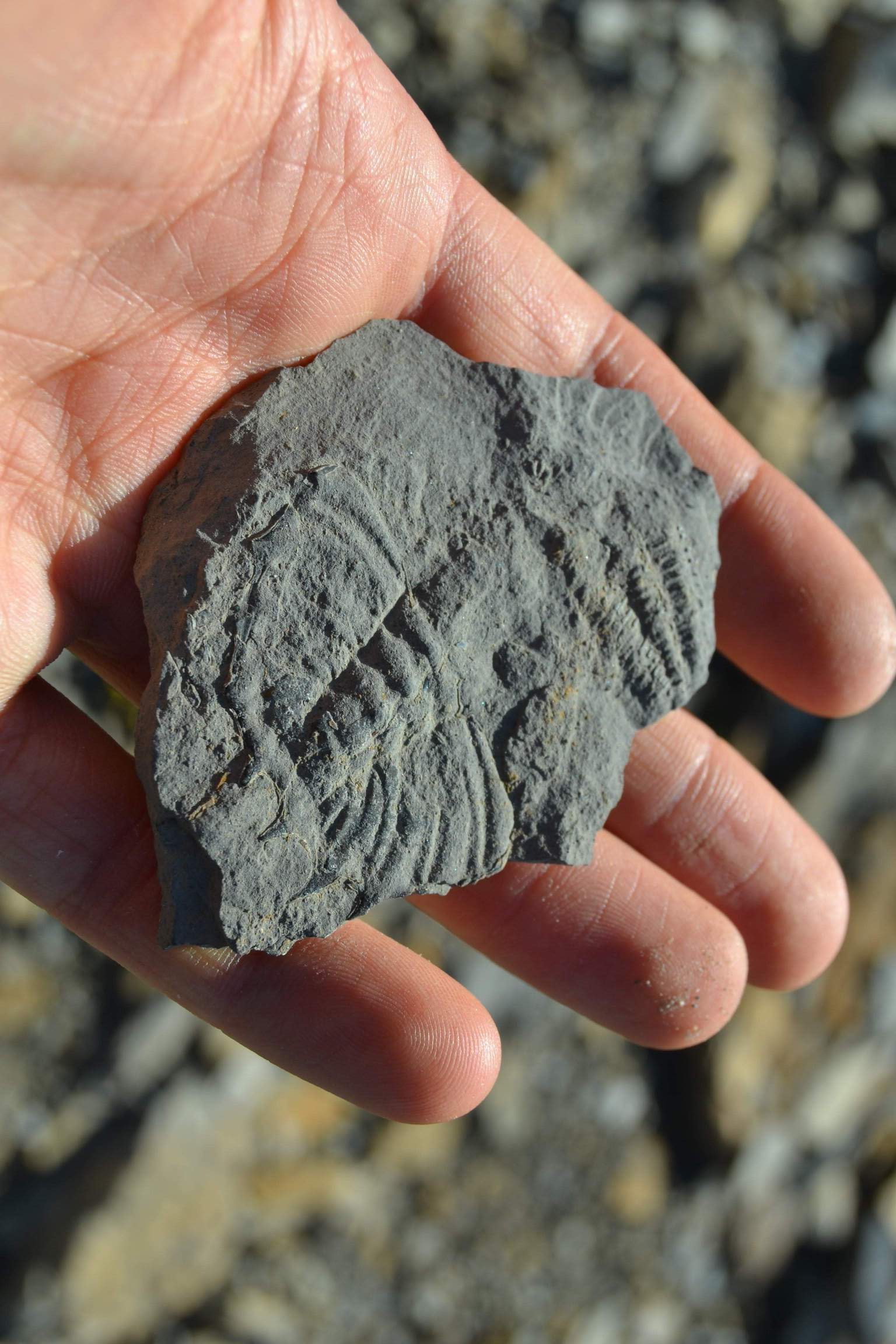
Peak: Mount Field
Date: 05/08/2019
Region: Yoho NP, BC
Distance: 14.5km
Elevation gain: 1400m
High point: 2643m
Difficulty: Easy scramble
Notes: This hike is basically on the Burgess Shale, there are amazing fossils everywhere showing weird and wonderful creatures from the Cambrian Explosion. I resisted the very strong urge to take one (damn you Kantian ethics).
Peak: Bow Peak
Date: 07/08/2019
Region: Icefields Parkway South, AB
Distance: 12km
Elevation gain: 1055m
High point: 2868m
Difficulty: Easy scramble
Peak: Mount Niles
Date: 08/08/2019
Region: Yoho NP, AB
Distance: 23km
Elevation gain: 1350m
High point: 2972m
Difficulty: Easy scrambling
Notes: The whole route is incredibly scenic. Each stage reveals new vistas, spurring you on. One of our favourites.
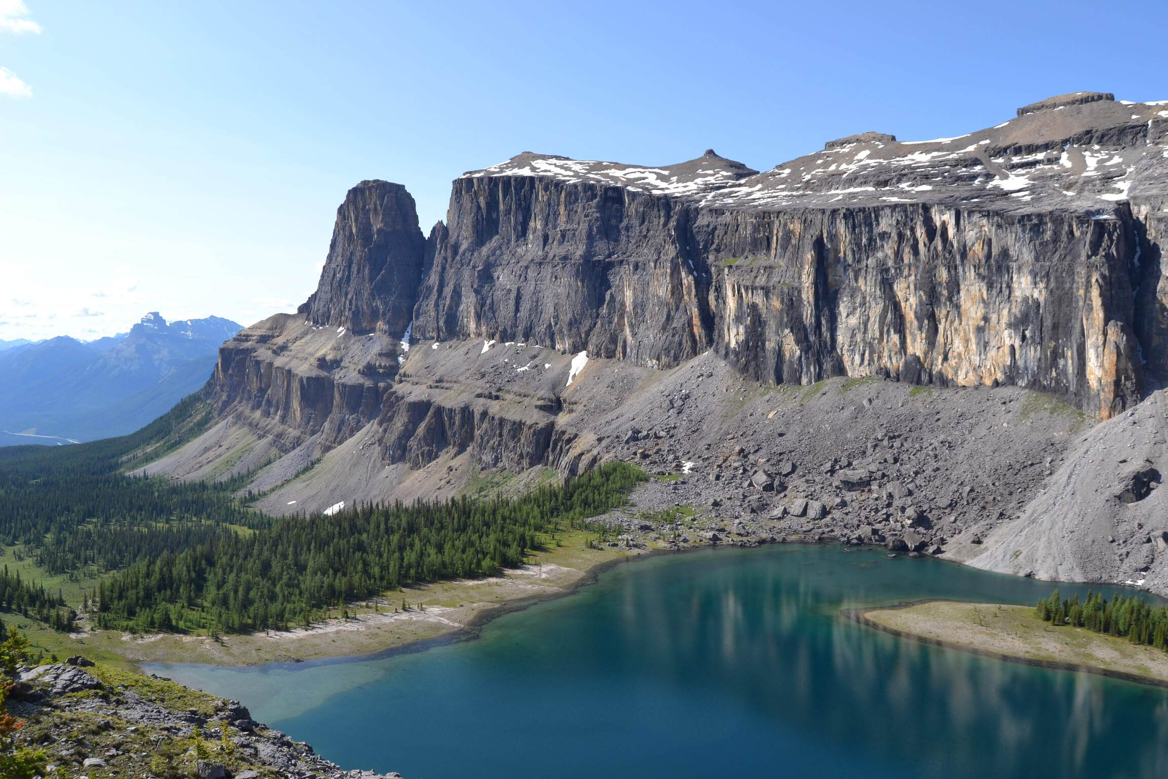
Peak: Cirque Peak
Date: 13/08/2019
Region: Icefields Parkway South, AB
Distance: 16km
Elevation gain: 1100m
High point: 2993m
Difficulty: Easy scramble
Notes: Popular
Hike: Caldron Lake
Date: 14/08/2019
Region: Icefields Parkway South, AB
Distance: 14km
Elevation gain: 1000m
Difficulty: Moderate to difficult hike
Notes: There is a long and very cold crossing of the many streams that feed into Peyto Lake. The water comes directly from the Wapta Icefield and it feels like it.
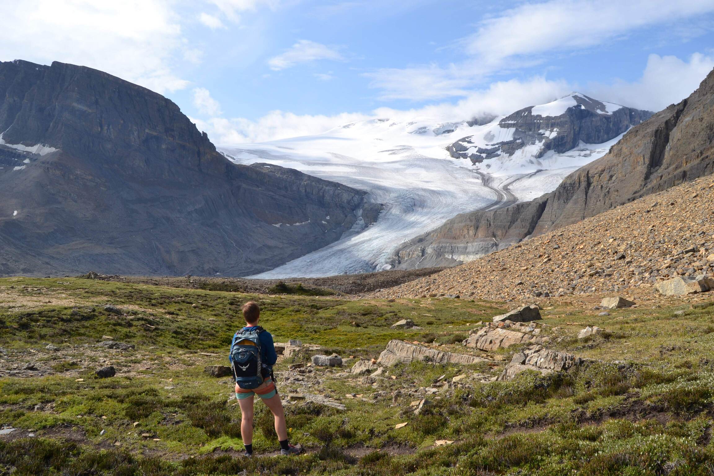
Peak: Sunwapta Peak
Date: 15/08/2019
Region: Icefields Parkway North, AB
Elevation gain: 1750m
High point: 3315m
Difficulty: Easy scramble
Notes: Quite a slog getting to the top, but it does feel very high.
Peak: Mount Wilcox
Date: 16/08/2019
Region: Icefields Parkway North, AB
Elevation gain: 850m
High point: 2892m
Difficulty: Moderate scramble
Notes: This was the most “scrambly” of the peaks we did, rather than lots of scree slopes, this one was more often on rocks and required the use of hand a lot. Very good fun.
Peak: Mount Wilcox (again)
Date: 17/08/2019
Region: Icefields Parkway North, AB
Elevation gain: 850m
High point: 2892m
Difficulty: Moderate scramble
Notes: So much fun in fact that I did it again. The first time was alone, the second time Lina joined me.
Peak: Hawk Mountain
Date: 19/08/2019
Region: Jasper, AB
Distance: 16.8km
Elevation gain: 1550m
High point: 2554m
Difficulty: Easy scramble with one moderate section. The book described it as difficult, but we didn’t find the crux that bad.
Notes: Nice views and an interesting route the whole way.
Hike: Verdant Pass
Date: 20/08/2019
Region: Jasper, AB
Distance: 22.5km
Difficulty: Easy hike, but route-finding was difficult.
Notes: Great views and a wild feeling one you actually get in to Verdant Pass. On the GPS map we were using there was a trail marked further downhill along the valley, but we got lost trying to find it on the way back.
Peak: Roche Miette
Date: 21/08/2019
Region: Jasper, AB
Elevation gain: 1300m
High point: 2320m
Difficulty: Moderate scramble
Notes: Lots of loose rocks and scree. I was knocking down lots of stones, thankfully I didn’t see a party behind me. Bring a helmet!
Hike: Three Brothers Mountain
Date: 26/08/2019
Region: Manning Park, BC
Distance: 20.4km
Difficulty: Easy hike
Notes: I think this was rated as 5 stars in our guidebook, it was certainly nice, but this may have set the expectations too high.
Peak: Frosty Mountain
Date: 27/08/2019
Region: Manning Park, BC
Distance: 21.2km
Elevation gain: 1200m
High point: 2426m
Difficulty: Moderate hike
Notes: Lina was attacked by a grouse.
Hike: PCT Northern Terminus
Date: 28/08/2019
Region: Manning Park, BC
Distance: 30km?
Difficulty: Easy hike
Notes: Since we were in the area, I thought I’d hike back the the PCT Northern terminus just over a year after I finished. I did a loop via the Castle Creek trail.
Peak: Illial Mountain
Date: 29/08/2019
Region: Coquihalla Pass, BC
Distance: 18km
Difficulty: Easy hike
Notes: Quite a long gravel road to get to the trail head.
Peak: Needle Peak
Date: 31/08/2019
Region: Coquihalla Summit Area, BC
Distance: 9km
Elevation gain: 800m
High point: 2090m
Difficulty: Easy-moderate scramble aided by a few ropes.
Peak: Mount Rohr
Date: 02/09/2019
Region: Cayoosh Range, BC
Distance: 18km
Elevation gain: 1100m
High point: 2423m
Difficulty: Moderate-difficult hike, some sections without a trail.
Notes: Seemed popular, but we may have been there near a public holiday.
Hike: Wedgemount Lake
Date: 03/09/2019
Region: Whistler, BC
Distance: 13km
Elevation gain: 1300m
Difficulty: Moderate hike
Hike: Skywalk North
Date: 04/09/2019
Region: Whistler, BC
Distance: 24km
Elevation gain: 1020m
Difficulty: Easy hike
Hike: Rainbow Pass
Date: 05/09/2019
Region: Whistler, BC
Distance: 20km
Difficulty: Easy hike
Peak: Brandywine Mountain
Date: 06/09/2019
Region: Whistler, BC
Distance: 18km
Elevation gain: 1500m
High point: 2213m
Difficulty: Easy scramble
Notes: We crossed a snowfield near the top that I guess stays here year-round. Great views of the incredibly dramatic surrounding peaks.
Hike: Panorama Ridge
Date: 07/09/2019
Region: Garibaldi Provincial Park, BC
Distance: 30km
Elevation gain: 1500m
High point: 2133m
Difficulty: Easy hike
Notes: Extremely popular, big trails the whole way. Amazing views.
Peak: Stawamus Chief (again)
Date: 16/09/2019
Region: Squamish, BC
Difficulty: Moderate hike